
|
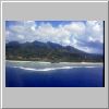
JPEG 828x522x16M [32 KB]
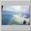
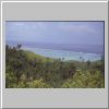
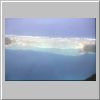
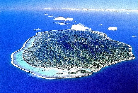
A daytime view of Rarotonga, as the plane prepares to land. Not many tourists can enjoy this view: most international flights land and take off at night. That's called globalization of flight schedules. |
|
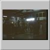
JPEG 834x534x16M [29 KB]
The Rarotonga International Airport is a nice little establishment, which might look a little pictoresque and out of the ordinary compared to your average airport. However, wait till you see the airports on the other islands. It is common to see entire families and parties waiting for their beloved ones to arrive, with loads of perfumed lei-lei (flower necklaces) whose smell can be rather pervasive. |
|
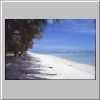
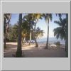
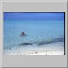
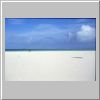
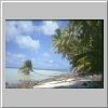
JPEG 834x534x16M [36 KB]
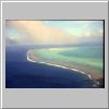
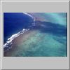
Picture-perfect beaches abound around Rarotonga. The island is surrounded by an almost uninterrupted coral reef, which makes for a lagoon with warm, calm waters. What the picture doesn't say, is that the lagoon is only waist-deep almost everywhere, and at low-tide it's impossible even to swim. It is a shame that no tourist book or guide mentions that the so-called paradise lagoon is in fact a giant puddle. Only the most naive stop-over tourists can get excited at the prospect of having this as a beach for the entire length of their stay. |
|
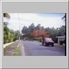
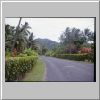
JPEG 828x534x16M [47 KB]
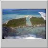
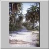
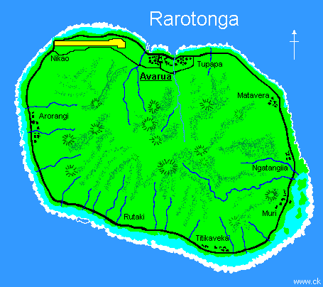
There are essentially only two roads on Rarotonga: the well-maintained main road, which circles the island along the coast, and... |
|
JPEG 816x546x16M [50 KB]
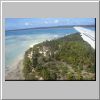
...the inner road, which makes a smaller, incomplete circle around the island. This is built on the original track used by the natives, which used to live more inland than today. |
|
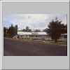
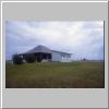
JPEG 816x510x16M [33 KB]
The Parliament of the Cook Islands is a curios sight. It has been built on the site where the barracks for the airport contruction workers used to be. |
|
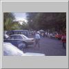
JPEG 816x534x16M [40 KB]
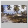
Just outside Avarua, the main market is held on Saturday mornings. The offer of fruits and vegetables, as well as cooked food and miscellaneous items, is not particularly wide. Nevertheless, this is reputedly the main attraction as far as shopping goes. |
|
JPEG 822x546x16M [66 KB]
As on many other island states of the Pacific, the missionaries have left a permanent mark. The extent to which christian religion is perceived and implemented is often beyond the grasp of logic. However, graveyards constitute an interesting visit, both for their style and for the original obituaries. |
|
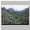
JPEG 816x546x16M [56 KB]
Rarotonga's interior is mountainous and thick with lush vegetation. Hiking is an interesting diversion from foot-washing in the lagoon. |
|
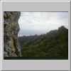
JPEG 810x570x16M [48 KB]
A quick hike (45 minutes) takes you to the Needle, a sharp peek from where one can enjoy a view on the other elevations all around... |
|
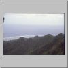
JPEG 828x534x16M [26 KB]
...or a view of the coastline surrounded by the coral reef. |
|
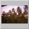
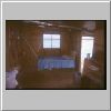
JPEG 816x534x16M [48 KB]
At the guesthouse where I was staying, a quiet evening spent in the midst of local animal and vegetation... |
|
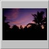
JPEG 816x546x16M [23 KB]
...turns into a beautifil sunset. |
|
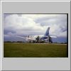
JPEG 816x534x16M [31 KB]
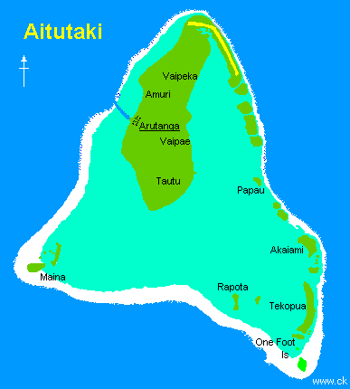
On the track at the Rarotonga airport, the new Saab turbo-propeller recently introduced by Air Rarotonga to accomodate the increased flow of tourists to the next most-visited island in the Cook Islands: Aitutaki. Most of the visitors go there for a day-trip only. |
|
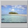
JPEG 816x534x16M [23 KB]
The Aituaki lagoon is one of the most spectacular I have ever seen. At least if you look at it from the air. |
|
JPEG 816x534x16M [24 KB]
The breath-taking beauty of the lagoon goes on... |
|
JPEG 816x534x16M [32 KB]
... and on. |
|
JPEG 816x534x16M [40 KB]
The Aitutaki lagoon is totally encircled, and only very shallow passages connect it to the open ocean. Only near the harbour, the Arutanga passage is deep enough to let small boats through. Ferries and ships must anchor outside the harbour. |
|
JPEG 816x534x16M [45 KB]
On a secluded edge of the lagoon, this motu has been altered to host a luxury hotel. Even the beach has been enlarged, so that the rich customers can have the illusion of a tropical paradise. Drowning is impossible. |
|
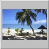
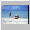
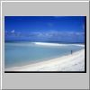
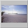
JPEG 822x540x16M [25 KB]
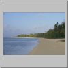
On the west side of the Aitutaki island, this is probably the best stretch of beach. Peaceful and beautiful. But forget swimming: it's waist deep at high tide. |
|
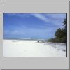
JPEG 822x522x16M [47 KB]
Same beach, seen from the backpackers' place where I was staying. Highly recommended, but unfortunately it's already fallen prey to the european tourists,the type that book one year in advance. It was full at the time of my visit, and I was kicked out after 3 days. |
|
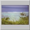
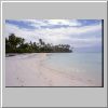
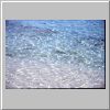
JPEG 822x522x16M [46 KB]
The reef is only 200 meters away, but swimming is almost impossible in the shallow water. Nevertheless, if you have good shoes and a mask, a sort of swimming hike is highly rewarding. |
|
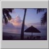
JPEG 816x552x16M [33 KB]
Another day is gone. |
|
JPEG 816x546x16M [37 KB]
The west side of the Aitutaki lagoon, seen from the highest elevation on the island. If you "jump" into the ocean from the reef, the view is amazing. Clear, deep waters. However, you have better go out with a boat from the main harbour. Swimming back on your own is extremely hard, and should be avoided unless you are a very strong swimmer. I have been told that a swimmer got lost a few months before. Of course, I heard this only after I had done it. |
|
JPEG 822x522x16M [37 KB]
The combination of colors is breath-taking, and is more than my scanned pictures can show. |
|
JPEG 822x522x16M [35 KB]
View of the Maina motu, from a tiny little leaking boat I had rented with two other people. I was beginning to understand what Colombus felt when he finally saw land. |
|
JPEG 822x546x16M [33 KB]
Another view of Maina, with one hand on the camera and the other on the leak. |
|
JPEG 828x540x16M [39 KB]
Land, finally. |
|
JPEG 828x540x16M [38 KB]
Never want to go back home again. |
|
JPEG 822x540x16M [29 KB]
Maina has a number of day-time visitors. However, nobody is allowed to stay the night. Aitutaki is in the background. |
|
JPEG 828x552x16M [28 KB]
A few minutes of walk away on the patch of sand exposed by the low tide, is another small motu. |
|
JPEG 828x540x16M [33 KB]
In spite of the lagoon cruise tours which dump tens of tourists for a lunch break, if you are on Maina on your own you can enjoy peace and solitude most of the time. |
|
JPEG 822x540x16M [19 KB]
A mistery plant tries to grow on a stretch of sand, which is covered by sea water with every tide. |
|
JPEG 822x540x16M [30 KB]
Can't get tired of Maina. |
|
JPEG 822x522x16M [26 KB]
Early morning at the Aitutaki airport. |
|
JPEG 822x534x16M [31 KB]
Finally, to the plane that will take me to Manihiki, a dream about to come true. |
|
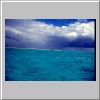
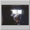
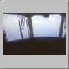
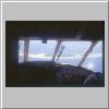
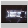
JPEG 786x558x16M [51 KB]
The actual flight is a bit boring. Ocean and ocean and ocean. The pilot has come well equipped (the co-pilot didn't, and he is actually sleeping). |
|
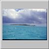
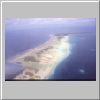
JPEG 828x522x16M [34 KB]
Finally, the Manihiki lagoon in sight! |
|
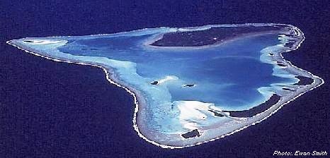
JPEG 828x522x16M [45 KB]
Unlike Rarotonga or Aitutaki, Manihiki is a real atoll, with an uninterrupted reef dotted by several motus. |
|
JPEG 822x540x16M [23 KB]
The lagoon inside is deep, and dotted by small kawas islets which are used to establish pearl farms. |
|
JPEG 822x540x16M [20 KB]
On the ocean side, the waves mark the reef edge. From there, the drop to the ocean bottom is very steep. The rise in the number of sharks also. |
|
JPEG 834x546x16M [38 KB]
The airstrip. With one flightr per week, its main customers are the pigs. |
|
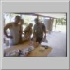
JPEG 834x546x16M [36 KB]
Finally I join the family which will host me for one week. It happens to be the uncles' birthday... |
|
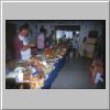
JPEG 834x546x16M [47 KB]
...but wait till the evening, when the real party takes place. Celebrating departing relatives. During the New Year holidays, many local people which have emigrated to find better jobs, come back to their relatives on Manihiki and Rakahanga. |
|
JPEG 828x552x16M [46 KB]
Walking on the motus and along the reef is a hard and long hike, but the views are unique. |
|
JPEG 822x546x16M [37 KB]
I was the only tourist on the whole atoll. The "crowds" of Rarotonga and Aitutaki are a distant memory. |
|
JPEG 816x534x16M [43 KB]
A pearl farm, built on a kawa which reaches just below the surface of the water. |
|
JPEG 834x534x16M [52 KB]
Spending a few days there alone is a unique experience. The only company are the seabirds... |
|
JPEG 834x546x16M [30 KB]
... and the crabs. |
|
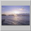
JPEG 822x546x16M [35 KB]
The time between sunset... |
|
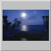
JPEG 822x516x16M [34 KB]
... and moonrise is magic. |
|
JPEG 828x540x16M [68 KB]
The shallow, ankle-deep waters inside the lagoon are full of baby sharks. They are much less shy than their parents, and if you happen to have a few bleeding cuts on your feet you will get a very close look at them. |
|
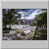
JPEG 816x534x16M [56 KB]
Unfortunately, a terrible hurricane struck Manihiki on November 1, 1997, leaving many casualties. The signs of destruction are still visibile. The waves covered the land completely, and it is still possible to see pieces of boats, engines, tires, trees, and fridges on the bottom of the lagoon. |
|
JPEG 540x834x16M [103 KB]
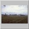
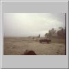
On the main road, traffic is not a problem. |
|
JPEG 816x516x16M [29 KB]
Time to leave, under the pouring rain. When the weather gets rough, it is easy to see how isolated and vulnerable these small islands are. |


